In addition to providing a variety of land services to our clients, we seek to be a leader in the industry. We do this by providing information and serving as a resource for the industry as a whole and our fellow professional surveyors. Check out our infographic library and don’t hesitate to contact us if there is anything else we can help with.
Infographic Library
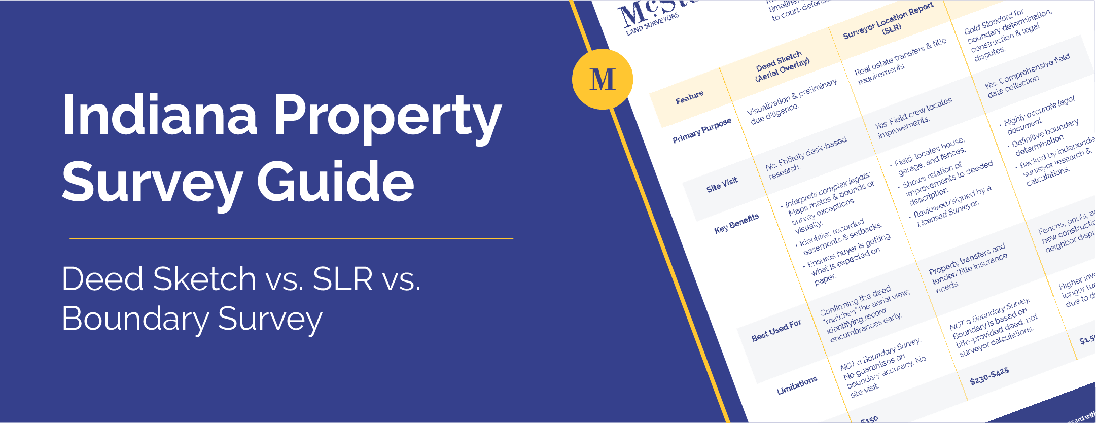
Indiana Property Survey Guide: Deed Sketch vs. SLR vs. Boundary Survey
Summary: Not all property surveys are the same. Learn the differences between a Deed Sketch, Surveyor Location Report (SLR), and Boundary...

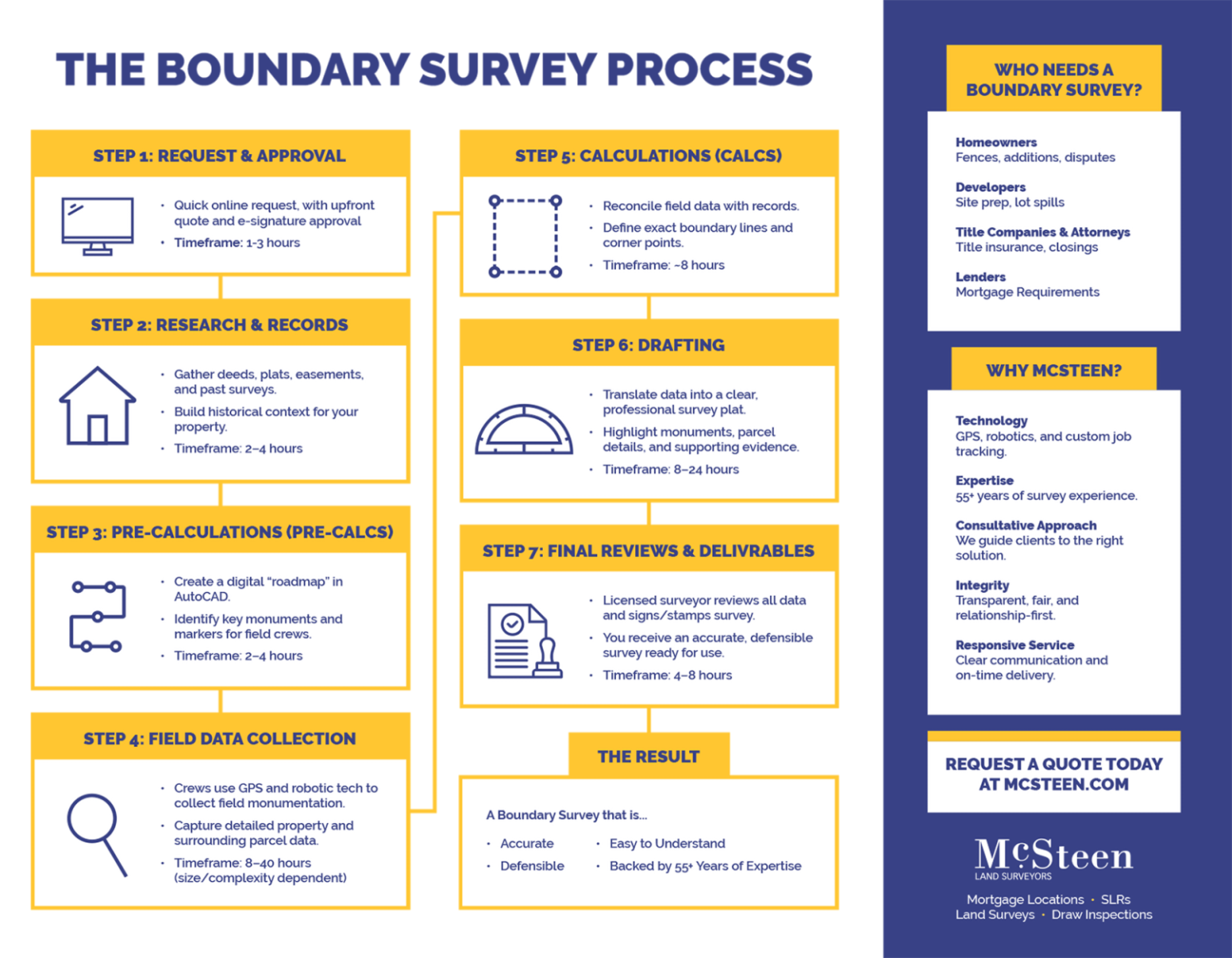
The Boundary Survey Process in Ohio
The Boundary Survey Process at McSteen Step 1: Request & Approval Step 2: Research & Records Step 3: Pre-Calculations (Pre-Calcs) ...
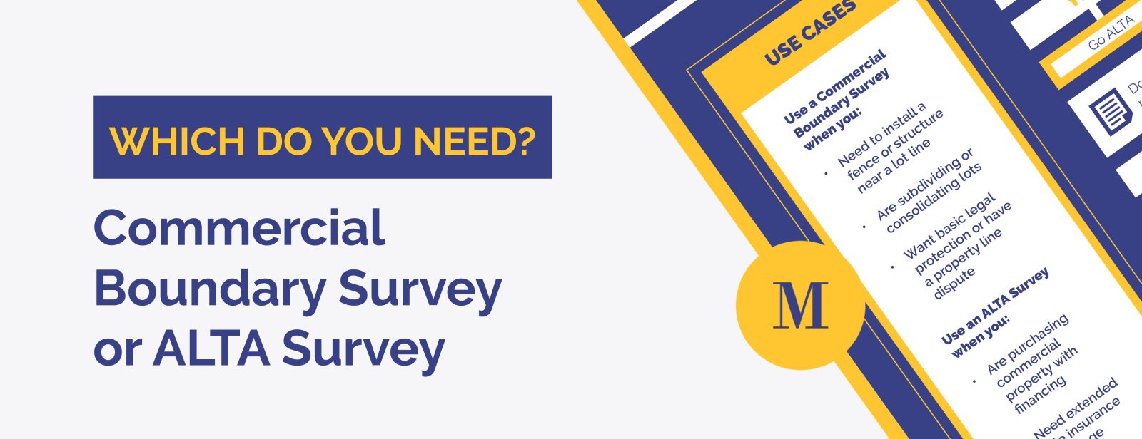
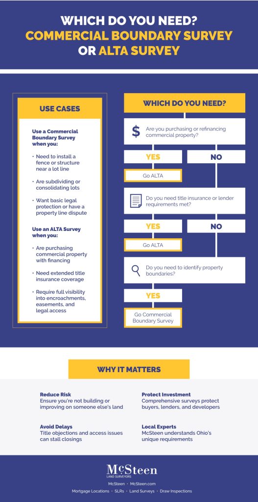
Which Do You Need? Commercial Boundary Survey or ALTA Survey in Ohio
Understand the key differences and when to use each. Choosing the right land survey ensures accuracy, protects investments, and satisfies...

The Purpose of a Mortgage Location | SLR
What: A Mortgage Location, also known as a Surveyor Location Report (SLR), is a detailed map or drawing of a...

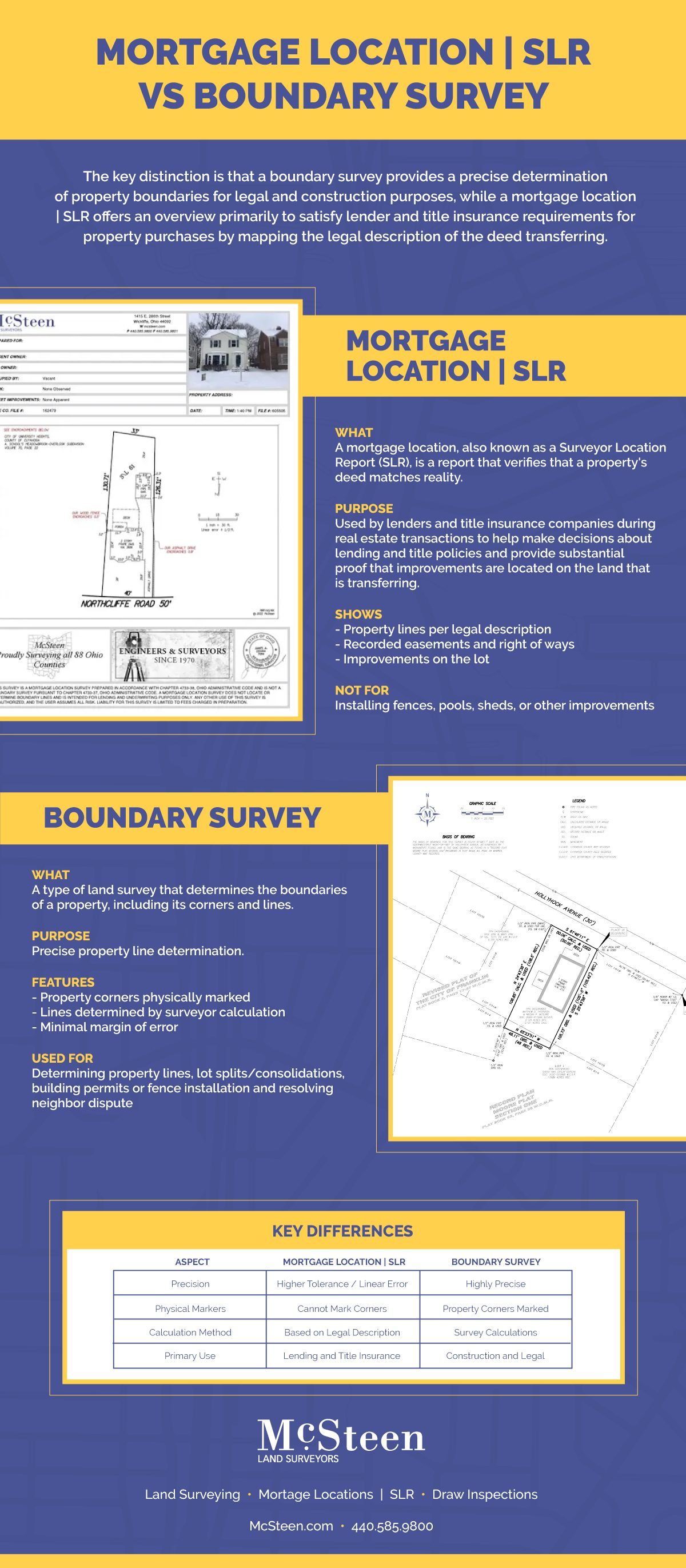
Mortgage Location | SLR v. Boundary Survey
Mortgage Location | SLR What is it? A mortgage location, also known as a Surveyor Location Report (SLR), is a...

Career Opportunities at McSteen
Work with McSteen Our team of Survey and Inspection Professionals is our greatest asset! And we’re always looking to build...
Introducing Survey Tracker
Our new software platform is designed to enhance the experience of our title and lending partners with ordering, tracking, and...

A Guide to Commercial Draw Inspections
Transcript: A commercial draw inspection is used to ensure the lender, contractor, and site owner are aligned on the construction...

Commercial Mortgage Location vs ALTA Survey
The purchase of commercial real estate can be complicated and involves a significant investment. A land survey ensures the buyer...