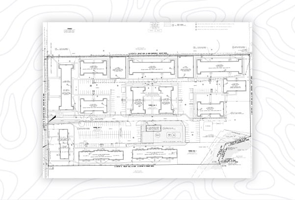
Land Surveying
Boundary Surveys

Boundary surveys are performed to locate, describe, monument and map precise boundaries and corners of a land parcel.
Topographic Surveys

Learn the elevations or relief of your property for a site plan or new construction through a topo survey.
Lot Splits

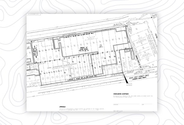
Lot splits and consolidations can be used to divide and consolidate land according to your specifications, while meeting county requirements.
Flood Certification

A flood certification may be needed for flood insurance, a loan or new construction.
Aerial Surveys

Drone mapping and surveying can accompany traditional surveying methods to significantly reduce time and cost.
Site Plans

Site Plans are instrumental to the design of any commercial or residential construction project for structure, concrete and improvement placement.
Easements

Easements allow a separate party temporary or permanent use of a portion of your land.
Construction Staking

Construction staking is necessary during site prep to ensure the builder knows where to place improvements.